Saturday, July 30, 2022

New Club Website

 The BMHGC website has moved to a new location. 


https://bluemountainssoaring.club/

https://bluemountainssoaring.club/

https://bluemountainssoaring.club/


Please have a look there for the most current club information. This website will remain here for a while longer as all the information is moved to the new site.


Stay safe and happy flying!

Tuesday, September 29, 2020

Friday 2nd October

 If you're hoping to fly at Blackheath this long weekend, I suspect Friday will be your only chance.

At present, it looks like a cracking day, although spring punch in the air.

Light westerly winds all day. Base at about 2600, 3+ m/s climbs (probably peaks of 6). Not ridge soarable, you'll need the thermals.

I reckon it'll be on properly by 11am. If you're a lower airtime pilot, plan to fly early (why not start with a sleddie at 9, then a second flight, landing by noon), then flying again at 3.30 - 4pm when it mellows out again. The early afternoon promises to be strong.

Minimal chance of seabreeze coming through before 6pm.

I'll update closer to the day as the forecast resolves.

Friday, August 28, 2020

Weather 29th August

 Weather.

Looks like you'll get a fly tomorrow (saturday), assuming that the reality of the wind is not too northerly. Given the northerly component, maybe plan to launch after noon, so that the sun helps pull cycles round onto the west side.

Base around 2000m, so a bit chilly. Bring warm things.

Spring is knocking at the door, so there are likely to be some rowdier thermals at times.

It is getting to the time of year for lower airtime pilots to take care, and really listen to what your SOs have to offer.

Have fun. Hope your hands don't hurt too much as they rewarm.

Sunday. Do something else.

Wednesday, July 29, 2020

Weather 1st and 2nd August

Looks like a flying day on Saturday for PG and HG.
Not super high, maybe 1500m base, 1.5 m/s climbs, winds westerly all day, increasing to 20kmh thru afternoon. Blue sky.

Sunday. Maybe, maybe not. Some models showing a better day than Saturday, others hinting that it'll be an easterly flow from mid morning onwards. Higher base 1700m, lighter wind, some high cloud slowing climbs down. Maybe a "check forecast again on Saturday to see what the updated wind forecast says" sort of day.

Be prepared to be accommodating on launch with other free flyers. Work efficiently to get off the hill, and not block up launch areas or runways. If there are PGs and HGs, please take the time to get an alternating launch sequence up and running. Remember that everyone is there to have fun, not argue about which type of free flight you currently prefer.

Thanks.

Thursday, July 16, 2020

Weather 18 and 19 July

Brief weekend weather. Not super promising.

Saturday maybe, but will not be straight so tricky to get off, and light winds so not soarable, you'll need to find a thermal to stay up. Probable high cloud will slow thermal activity, tops at 1400m.

Sunday, blown out for PGs.

Thursday, July 9, 2020

Weather 11 and 12 July

Flying forecast for the weekend 11 and 12 July.

Just no.

Go fix the leaky bits on your house in preparation for Monday and Tuesday.

See you the week after.

Thursday, June 25, 2020

Weather 26th to 28th June

Weather outlook for 26th to 28th June.

Mixed weather. Likely cloud cover for Friday and Saturday might dampen things down somewhat. Friday and Sunday probably most promising if you can get off the hill. Sunday looks like the most sun potential. Likely mild OD on saturday.

Thermal strength and height for the weekend slightly below average for this time of year.

Looks likely that there'll be a shallow SE wind layer below the westerly over the next few days. Unsure if Blackheath will poke up thru it and give flying for us.

Sorry, not a very excited ramble this week. I think it'll be very much a look and see if you are in the area this weekend.

Friday, June 12, 2020

Weekend 13 and 14 June

No flying this weekend.

But if you are lucky to have an extended weekend, Monday looks promising.

Wednesday, June 3, 2020

Weather, weekend 6th and 7th June

Looking at continuing the weekend weather blurb, now that finally it looks like some more consistent flying conditions. Will aim to post here on wednesday or thursday evenings, regarding the weekend's potential.

This weekend, (Friday and) Saturday look like decent conditions for a fly around. Sunday may prove good for more experienced pilots

Friday, base around 1700, 2.5 m/s climbs, blue, 10 to 15kmh westerly winds.

Saturday, base around 1900, 3+ m/s climbs, blue at first then high cloud in arvo slowing things down, 10 to 20kmh westerly winds.

Sunday, base around 2100, 4 m/s climbs, cus in the arvo, less than 10kmh southerly. Hard to get off, but might have some good flying if you are ready for the rough leeside climbs.

Remember if you are a lower airtime pilot and / or haven't flown Blackheath for a while, get an induction from an SO, chat about conditions, and plan to fly before 11am or after 3pm. It is still thermic air. Last week, pilots were reporting strong 5 m/s punchy climbs.

There may not be many SOs available in the middle of the day on this Saturday, just a heads up. If you plan ahead, an SO should be able to help before 11am on Saturday.

And a reminder, we are encouraging effective social distancing. More than half the pilots will be hiking up (30 to 60+ minutes beautiful stroll) and the rest hopefully will be doing socially distanced and  responsible car pooling.

Thank you, and remember your warm woolies.
Monday, March 23, 2020

Mount Blackheath flying advice

The Blue Mountains Hang Gliding Club executive requests, that with the efforts to manage COVID-19 requiring a collective community response,  all pilots consider the appropriateness of flying from the Mount Blackheath launch for the coming months.

The Blackheath launch, and resulting free flight activity conducted, is in a relatively remote location. The pick up or LZ retrievals required would be difficult to conduct in light of current health social contact guidelines and emergency management expectations.

While at present the land manager of the site has kept the site open this situation could change in the future resulting in formal site closure.

Please be a considerate and responsible pilot and seriously assess your need to fly at Blackheath during this current community threat.

BMHGC Committee

Sunday, January 19, 2020

Blackheath flying site OPEN again

Blackheath flying site OPEN for flying activities again.

Thanks for your patience.

The rain over the past week has eased conditions, and correspondingly the level of fire related air traffic in the region. If you plan to fly at the site, please check on this page or on our website that there are no new alerts.

On hotter days, be aware that there will be increased air activity monitoring for potential flare-ups.

Currently, we strongly advise that pilots avoid flying south of Katoomba / Wentworth Falls due to the most recent active fire front in that direction


* On another note, a reminder for pilots intending to fly Blackheath, that you must be a current SAFA member in order to fly there. Failure to do so might place the site in jeopardy. Thanks *

Tuesday, January 7, 2020

Marangaroo Airspace update for 2020

This is a post to update the information for flying over the Marangaroo Military Restricted area. This is just north of Lithgow over the hills behind the tip.

The previous post, with outdated information is here

The Identifier code for this airspace is now R522, not R520.


Details are:
  • Identifier code R522.
  • Status: Conditional Status RA3: Pilots must not flight plan through the Restricted Area and clearances will not be available.
  • LATERAL LIMITS: A circle of 1.1 NM radius centered on 33,25,39S 150,09,23E
  • Heights: SFC - 6500 feet
  • Time Limits: by NOTAM
  • Contact for more detail: Army RCO Holsworthy 02 8782 1288

You can check the NOTAM for R522. You want to see... 

" 
THE FOLLOWING REQUESTED LOCATIONS HAVE NO CURRENT NOTAM: 
R520 MARRANGAROO (R520)
"
 

Tuesday, December 17, 2019

18/12/19 Temporary closure of Mt Blackheath launch due to fire conditions

Mt Blackheath Launch Bushfire Risk

*** Update, closure extended, come back in the new year ***


Although the airspace remains open, the club committee believes that due to the bushfire emergency in the Blue Mountains, and forecast weather conditions, that pilots should not use the Mt Blackheath launch for the next four days at least.
In addition VMC are generally not achievable in the current conditions.

Significant bushfire activity is currently taking place in the upper Blue Mountains, to both the north and south of the launch. These fires are continuing to increase in size and the weather conditions over the coming days present significant risk to these fires behaving unpredictably.

Low level aircraft activity around the Mt. Blackheath launch is required in fighting these fires. It is critical that these aircraft, including helicopters, twin props and Large Aerial Tankers, are able to fly frequent paths at terrain level and on approaches as the immediate response situation requires. This includes across and over the Mt Blackheath launch as well as the surrounding cliff lines and valleys.

Friday, September 27, 2019

Outlook 28 and 29 Sept

Sorry, I've been working out of contact through the week.

Saturday, forecast looked likely to be blown out most of the day. Reality, it was flyable on the windier side. Looks like a number of pilots were in the air.

Sunday. Looks possible, maybe on the windier side in middle of the day when thermals are kicking through. Climbs 3 to 4 m/s. Some mid level cloud throughout the morning. Base about 2500. Mid to late arvo might offer some decent conditions for lower hours pilots.

The whole weekend was a bit of a funny call on the forecasts. Some suggested blown out strongly all weekend, others suggested OK. Could be a good weekend to go MTBing unless you are in the area and willing to make the call on conditions at the time.

Thursday, September 12, 2019

New RASP resource

The old RASP server was shut down, but Chris Dobinson in QLD has made this available to us.

The maps are more like google roadmaps, not the old statewide map, so some of the wording in our weather guide are not applicable. On the plus side though, you can just zoom in to work out exactly where you want to look at.

NSW RASP

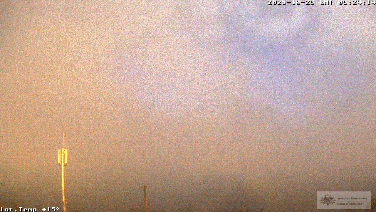
Webcam

Webcam

The 225 degree camera looks from Mt Boyce, across over the LZ, to the launch at Mt Blackheath.

For example, this pic shows Mt Blackheath just above the right hand pole (the smaller telegraph pole).


Wednesday, September 11, 2019

Outlook 13, 14, 15 September

My take on forecast.

13th. Light NW winds in the am, becoming W and blown out by 2pm, increasing thru the afternoon. Base about 2400 about 2pm. Climbs average 2.5 m/s. Blue.

14th. Mostly SW and S winds, but probable light east at launch height. Either launch 10am in SW before E pushes under, or possible launchable cycles lunchtime onwards. Base around 1900. Climbs 2.4 m/s.  Blue.

15th. W winds around 20kmh. Base 2500. Climbs 2.8 m/s. CUs 1pm onwards. High cloud 4pm onwards.

My thoughts.
Friday, maybe fly early with caution, land by noon. "Blowing out" forecast is not what I like in my flying forecast.
Saturday, looks reasonable if you manage to get off launch. Possible XC towards Lithgow. Convergence line setting up during the afternoon from Blackheath - Newnes.
Sunday, maybe, maybe not. The wind will probably be too much for PG to enjoy.

Remember that peak climbs likely to be double the average given here.

*** Warning though, spring seems to have well and truly sprung early this year, conditions are already boisterous. If you are a low airtime pilot, expect that safety officers will advise flying outside of peak of day conditions.

*** If you haven't already read it, flip through our weather primer to help your understanding of Blackheath's weather puzzle.

*** Please note that the Mt Blackheath Holfuy is not working properly and needs maintenance.

*** These posts are intended as a reference only, they do not supercede the responsibility of a pilot making the call to not fly.

Monday, September 9, 2019

Weekly weather posts

The club is trying to restart regular blog posts on weather in particular. Please have a read of these if you want some help deciding if a trip up to the Blue Mtns is worthwhile.

I'll try to post on thursday evenings a take on the weekend opportunities for flying. In addition, if it looks promising for the mid week ahead, I'll add a brief mention on the thursday post, but probably less detailed as there are likely fewer pilots mid week.

This weekend just past was characterised with strong winds associated with multiple clipper fronts passing the SE corner of Aus. These winds have been prevalent for many days, but are beginning to back off this evening (Monday). Wednesday currently looks promising for the first fly in a while; light westerly winds, with base around 2300m.

Sunday also looks promising at present, and hopefully will look good on the thursday post.

*** Warning though, spring seems to have well and truly sprung early this year, conditions are already boisterous. If you are a low airtime pilot, expect that safety officers will advise flying outside of peak of day conditions.

*** If you haven't already read it, flip through our weather primer to help your understanding of Blackheath's weather puzzle.

*** Please note that the Mt Blackheath Holfuy is not working properly and needs maintenance.

*** These posts are intended as a reference only, they do not supercede the responsibility of a pilot making the call to not fly.

Tuesday, June 18, 2019

Blackheath site temporary closed for work

Council will be replacing the hang gliding ramp on the Blackheath West launch this Thursday 20th June, and Friday 21st. The west launch will therefore be closed to both HG and PG on these days or until the work is completed. Don't waste a trip up the hill before checking if the work is complete.

Sunday, May 6, 2018

Back in Black - Club comp

There was a task held for the BMHGC club comp this weekend. 3/8 pilots made goal in Lithgow. Another reason to join the club. Che, Kacper and Andy made it to Lithgow. Well done guys!


High Cloud: TASK 1

Tuesday, February 20, 2018

Radio prociedures for flying around Bathurst - from the Bathurst soaring club

For all pilots flying from sites around Bathurst and Orange, please have a read of these radio procedures shared from the Bathurst Soaring club. It is complicated and busy airspace with several regular public transport flights through the area plus three airfields. There is a handy map at the end that shows which frequencies to use in which areas. The icom Air Band Transceiver that we all use can be programmed with these frequencies, making it easier to switch between the different frequencies if you transition from one region to another (I have saved them as Bathurst, Pipers and Orange). I would advise all pilots to follow these same radio procedures if flying from Mt Rankin or Mt Ovens so we can be in communication with the other airspace users in the region. Pipers airfield is in the center of the black circle on the map. This is the airfield that is located just south of Mt Rankin.

http://www.bathurstsoaringclub.com.au/images/documents/Airspace_Procedures_Pipers_Airfield_v6.pdf

Please let me know if this link goes dead in the future.

Alex.

Wednesday, January 17, 2018

ACP 112-17 MILEX Black Dagger 15-23 March 2018

While it is unlikely that any flights from BMHGC sites will be reaching the airspace used in this exercise, there is usually an increase in activity by aircraft operating out of Richmond. I think Andy has a good story with a close encounter with a big air-force transporter flying out of Richmond. So stay alert in the lead up to, during and following on from this exercise.

The airspace activated is all in the lower hunter and around Singleton (R564A, R564B, R583B, D600 and R971), not those further west reaching Mudgee. You can find them on the airspace charts (previous post) or on the flight check page on www.xcaustralia.org. I can't post the .pdf with detail here, but if you really need a copy send me an email.


Sunday, December 10, 2017

Airspace charts now available free to download

The airspace charts from Airservices are now available to download free in pdf format. The relevant maps for out flying sites are the Sydney and Newcastle VNCs and the Sydney VTC.

http://www.airservicesaustralia.com/aip/aip.asp

direct link

Note the radio areas around the non-towered aerodromes are not shown, but you can easily find the aerodromes at Bathurst, Mudgee and Orange.

Edit May 2018: updated the link, slso if the page moves I found it under: Publications>Aeronautical Information Products (AIP)>AIP Charts (24 MAY 2018). There is also a copyright agreement you need to click.

Thursday, December 7, 2017

Updated the weather links

I fixed and updated some of the weather links that were broken.
  • The Windity link now goes straight to the map and airgram for Blackheath.
  • For the blipmap, use Camden (current day) or NSW 24 and 48h forecasts.
Some handy tips:
  • Windity has a handy precipitation forecast in the airgram.
  • Blipmap can show you when the thermals are likely to start by looking at the height of critical updraft strength and the cloudbase potential plots.

Sunday, September 24, 2017

Newcastle Hang Gliding Club Competition Dates

The NHGC has published their competiton dates for thsi season and asked us to share the information with our members.

    Central West Classic
Where  Gulgong Nsw
When  19th-25th November 2017
practice day 18/11/2017
sign in 6pm 18/11/2017 at gulgong airport
Sign up on the NHGC website competition page is open now


This competition is a AA rated aero tow comp open to all pilots with tow endorsements
Great comp for advanced,Intermediate and novice pilots.All details on
The Newcastle Hang Gliding Club Website


      Corryong cup 
Where Corryong Vic
When  7th-13th of January 2018
Practice day 6/1/2018
Sign up will be open Friday 1st of September 8pm on the Newcastle Hang Gliding Club
Website Competition page


 This comp is a B grade comp and is great for Advanced,Intermediate and novice pilots.
It is a foot launch comp launching off Mt elliott Corryong.Sign up fills up fast so be quick 
to sign up to secure your spot in the comp.Max pilots 75.All details on the NGHC
Website competition page.


   Manilla nsw state titles
Where Manilla Nsw
When   17-24 febuary 2018
Sign up is open now at the Newcastle Hang Gliding Club Website
Competitions page


            This comp is a great comp for Advanced,Intermediate and Novice pilots.
This comp is a foot launch comp flying off the premier site of Mt Borah Manilla
This comp is a AA rated comp.All details on the NGHC Website competitions page

Friday, July 28, 2017

Flying report from last Saturday (22 July)

Last weekend Saturday ended up as a nice morning before being blown out after lunch, similar to the pattern possibly repeating this weekend. A few experienced pilots turned up early and got in an hour and a half of thermic soaring in the sun on the north face at Blackheath. Climbs were not high, capped by the early start and the strong inversion at 1300 M. As sun and wind came around to the West, Ado and Owain were able to top land.

The rest of us were just getting ready, and waited for the wind to come on. There was only a short window to launch before the wind increased and the thermals started making it gusty on launch. In the air it was easy out front and rough over takeoff, with the strong inversion at 1300 M not budging. it was soon blown out for paragliders, but half a dozen hang glider pilots still launched and were playing in the thermic windy conditions. Very buoyant conditions made it possible to fly quite far out front of takeoff over the valley without really loosing much height.

An hour or so later, The three paragliders in the air soon called it quits and landed down in the bomout. There was a very strong wind gradient making setting up for landing challenging. The first of the hang glider pilots also landed soon after, making use of the large landing area to full effect as they hit a cycle when on final, drawing out the ground effect run and messing with their flair.

Later in the evening conditions mellowed for a while after 4:30. With no thermals, but still a strong wind, Julian launched in his mini-paraglider to enjoy the glassoff. Ado came back out and gave us some fun ground handling with his mini wing, before he also launched to join Julian. It backed off rapidly and I launched my paraglider to enjoy the soaring until sunset. We were all able to top land, with the wind backing right off at sunset.

Soon after sunset the wind started building again and kept up for the rest of the weekend. In all we had four days in one; early morning thermalling in light wind, strong ridge soaring with some thermals, hang-glider only strong ridge soaring and thermals and a sunset glassoff ridge soaring.

Alex.

New blipmap forecast, but too windy this weekend (29/30 July)

The early birds had a chance for a flight this morning, but judging from the BOM central tablelands forecast, and the new Camden blipmap forecast, It will be blown out for the rest of the weekend later this morning.

lets hope the windy August weather is not early.

Alex.


Friday, May 26, 2017

Weather Forecast is all over the place this weekend (27 - 28 May)

From yesterdays forecast I would have called this weekend flyable all weekend long. What a difference another 12 hours makes. I am not sure now.

For Today, from the BOM, today looks more possible over tomorrow. The Blipmap is now calling the winds to be from the NE and light early (which is what we are seeing on the Mt Boyce current readings) but later the wind will swing round to the NW and increase to >10Kts. Windity is also forecasting this to happen after the low cloud clears after 9:00AM. So Today could be flyable, depending on how well the wind comes around in the afternoon. Advanced pilots may be able to take advantage of the NW and lighter conditions to soar the North cliffs early, but should be careful (as always) that the wind doesn't come too far around to the West and make the North face trashy.

Like last Sunday (which I think i got wrong), it is defiantly a call from the hill by some experienced pilots.

For Sunday, the forecast now looks trash from BOM, with showers developing and the wind increasing throughout the day. Windity is not forecasting any rain, but does agree with the increasing winds, which may get too strong for flying from midday. If you are out early it may be a nice morning, but beware of the wind mixing down from high as the morning progresses. It is a classic trap that has caught out a lot of (experienced) pilots, where it is a lovely soaring morning, but as soon as some thermals start it gets blown out and before you know it your stuck up behind launch getting trashed. But if you are keen, early is key.

With the forecast being a little unreliable lately, I cant stress how important it is to have one of the BMHGC SOs present to make a call on the weather before you launch.

Good flying

Alex.

Friday, May 19, 2017

Flying today and tomorrow (20-21) if you can avoid the rain

I didn't post here yesterday because of the hype and noise about the rain coming out of the news all week. Waking up this morning in Sydney, it is not as wet as I expected, so some of us may be tempted to go for a flight.

The wind forecast (check blipmap and windity) doesn't have anything dangerous forecast at the current time, with conditions improving throughout the weekend. Rain and cloud wise, today is forecast to be wet this morning and then again  later this afternoon, which I would expect to be related to the thunderstorms forecast by the BOM. Windity, (aerogram) has 0.2mm this morning and 0.3mm this afternoon, so probably better to give it a miss.

Tomorrow, again has light rain early, with low clod hanging around until lunch time when it clears. This corresponds to the change in wind (blipmap) so I would expect Sunday afternoon to be quite nice. The rain today and tonight will keep things subdued thermal wise, so it may be quite a pleasant ridge soaring opportunity.

Having said all that, remember Blackheath is wedged between two forecast zones. So in reality, and especially this weekend, we will have to be there and observe.

Fingers crossed.

Friday, May 5, 2017

Windy forecast 6 and 7 May

The forecast for this weekend looks like it will be a bit too windy for flying. Saturdays forecast is missing from the Blipmap. The BOM has the wind as being on the strong side. Normally anything over 15 to 20 km/h means the day will be too strong. This is backed up by the Winidity forecast. Dragging the altitude scale up, the wind soon gets very strong. the forecast for the wind is to increase throughout Saturday and Sunday morning before easing in the afternoon on Sunday.

If we are lucky there is a slight chance of a glass off very late on Sunday afternoon, but that is a fair way off for the forecast and the direction is predicted to be very south in the current forecast...

Starting to get a bit tired of writing up bad forecasts. Where is the good flying weather?

Alex.


Friday, April 28, 2017

flying today and tomorrow. 28-29 April

Again I have missed the Friday post with the forecast. Sorry about that. Today looks like it is already on at Blackheath, so grab your gear and head out already! It should be on all day until sunset. The wind may be a bit crossed to the south and expect thermal activity off the cliffs during the day with the sun beaming down unhindered. Hopefully today's forecast was obvious enough so you didn't miss out.

Tomorrow (Sunday) looks like a nice day, but unfortunatly over the back at Blackheath. Check the updated forecast in the morning, experienced pilots may find something to push them along if they can launch. Better bet will be on the coast, Stanwell, Longreef etc...

Alex.

Friday, April 21, 2017

Flying this weekend - Forecast 22-23 April

Sorry for the late post. I wasn't near a computer today.

This weekend weather doesn't look that stellar for flying in the Blue Mountains. At first glance the BOM forecast paints a wet weekend. Looking at the Airgram on Windity, the rain is forecast to only happen early in the mornings or overnight, but the low cloud will hang around nearly on the ground most of the Morning. So back to the Blipmap animation and the wind is forecast to be suitable on Saturday afternoon. This is also when the cloud is lightest. Sunday has the wind swinging to the east early on in the day so no good.

So If we are lucky with the rain forecast, then Saturday afternoon may give us a window for some nice ridge soaring. But, this forecast is pretty difficult, so really needs a human observation from takeoff.

Good luck.

Alex.

P.S. If anyone is around, can they message me with the conditions so I can write a follow up with how the weekend was and gauge the accuracy of the forecast.

Thursday, April 13, 2017

Weather forecast for the long weekend

The forecast is for sunny skies with light winds, which is a nice outlook for the long weekend.

For Friday, the winds will be very light and crossed from the south, so later in the day after the sun has come around to the west face will make for some nice conditions. We may even be lucky to have enough energy for a glassoff. However, with the prevailing winds crossed from the south the lift may be light and it may be hard to stay up. It will likely be a mix of thermals or bunched up ridge soaring/thermaling at the northern end of the Mt Blackheath cliffs. Blue skies all day, but the forecast trace says it is unlikely to be inverted, just doesn't get quite hot enough to reach cloud base and climbs will be slow.

Saturday looks like the winds will mix down from late morning with the wind right on the face from the West. This could make it easy to stay up all afternoon. There should be a nice cloud-base of around 8000 - 9000 feet during the middle of the day. I would expect a nice glassoff in the evening.

Sunday is still a bit far off, but looks to be a repeat of Saturday.

Monday is too far off for now, but BOM is forecasting more unstable weather. Might end up being the best day of all four. But that is me daydreaming a bit...

So for me Saturday and Sunday afternoons are the best pick for most likely chance of flying for all, I just I hope i can be a part of it too. Low chance of being blown out but still possible if the thermals are strong.

I will try and post an update over the weekend. The forecast is really only good for tomorrow and the day after.

Alex.

Thursday, April 6, 2017

Lots of new interest in flying at Blackheath

It is that time of year again, when the seabreeze at the coast is unreliable and many new pilots are looking for a new place to fly.

I have fielded a lot of emails from new pilots asking about the weather this weekend or another time. The BMHGC uses a private message group for discussing flying, which is available to current BMHGC members. For all the visiting pilots and new pilots asking about club activities and weather forecasts I will be posting a weekly update here for the next few weeks, with a consensus from the club members, safety officers etc... So come back and have a look here before firing off an email. Don’t forget the weather forecast resources here. You will get a much friendlier response if you put in the effort to check the forecast before you send a message or ring someone local.

For this weekend, I will give my opinion to start with and make another post if there any different opinions. Please note this is just a prediction, so don't blame me if you drive up and find it is raining or decide to stay home and miss out. For the Mt Blackheath site, unless you have aPG5/HG5 rating, you need the OK from a BMHGC SO or SSO, on the day, on the ground, before you fly.

Saturday: The wind is from the North most of the day and light high cloud is forecast. You may have a flight if you are a topgun, but it wont be much fun. Takeoff will be impossible from Blackheath and there wont be any ridge soaring potential. At least it wont be raining so you can go for a bushwalk.

Sunday: Clear morning but raining in the afternoon. As soon as the sun comes out the wind will mix down and it will be blown out. Dangerous if you are tempted for a dawn/early morning flight.

Monday: At this stage the longer range forecast says dont get excited it will be raining. Come back and have a look for a chance over the long weekend if we are lucky.

Next forecast will be on the Thursday before the long weekend.

Thanks for your cooperation,

Alex Drew.

Tuesday, May 17, 2016

Westerly winds returning

We have started to see the return of Westerly winds for the Winter season, which brings a lot more pilots up to the mountains for a flight. this is just a friendly reminder for local pilots to help out pilots who are visiting and for visitors to please familiarise themselves with the restrictions in the site guide before attending and seek out a BMHGC SO/SSO for a site introduction before flying.

Thursday, February 11, 2016

Marangaroo Airspace R520

This page is now out of date. Please see the updated post regarding this airspace.

A couple of people asked me about airspace over Marangaroo, so this is a long overdue post and I needed to look up the details again myself.

Marangaroo is an army training area, so you shouldn’t fly over the base. Beyond this there is airspace as protection from the demolitions firing range. This is a restricted area so stay out.

Details are:
  • Name: R520
  • Status: Conditional Status RA3: Pilots must not flight plan through the Restricted Area and clearances will not be available.
  • LATERAL LIMITS: A circle of 1.5 NM radius centred on 33,25,39.4S 150,09,22.9E
  • Heights: SFC - 8500 feet
  • Time Limits: Week days excluding public holidays 7:30AM-4PM or as amended by NOTAM

You can see the area on the XContest maps as area R520. You can check the NOTAM for R520. You want to see...
" 
THE FOLLOWING REQUESTED LOCATIONS HAVE NO CURRENT NOTAM: 
R520 MARRANGAROO (R520)
"
 
Info from:Aeronautical Information Package (AIP), En Route Supplement Australia (ERSA), Effective 03-Mar-2016.


Alex